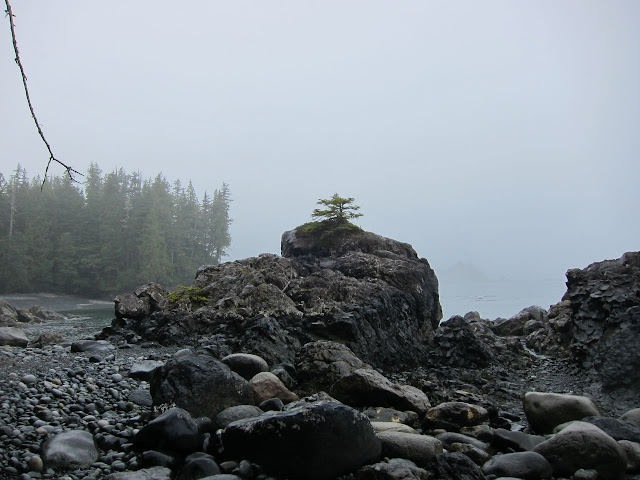
Hiking through a lush temperate rain forests and strolling on beaches in late August 2010
The North Coast Trail
(NCT) was my first coastal walk and it was also the first time for me
to get to see Vancouver Island. My itinerary was to finish the trail in
approx. 3 days and spent another 3 days in Cape Scott National Park.
The NCT is actually an extension of the aforementioned park and has
been finished just a few years ago. I always wanted to do the West Coast
Trail, but the NCT is less crowded and also cheaper and no booking is
required. There is just a $ 10 fee for every campsite.
I travelled
by float plane to Nainamo from Downtown Vancouver. Seeing Vancouver and
the Howe Sound from a plane is amazing and it is also the fastest way to
get to the Island (25 min).
 |
| Float plane port, Downtown Vancouver |
 |
| Lions Bridge, West Vancouver |
 |
| Howe Sound |
I caught the Greyhound bus to Port Hardy
from there. I took the water taxi with 3 other hikers to the eastern
trail head at Sushartie Bay the next day. It looked like it would rain any second on the first day, but it just
stayed foggy and humid. The water taxi dropped us off and
instantly returned back to Port Hardy. It felt a bit weird, we were on
the trail now and there was no way back. Let the adventure begin:
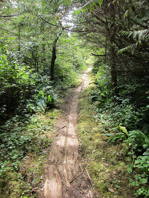
I had planed to hike alone, but another hiker from the hostel joint me for the first 4 days. The trail went through a lush and temperate rain forest. Fortunately there are some boardwalks, so it
didn't get to muddy. We had to gain some altitude and dropped back down
to sea level again. After about 4 hours we
reached the first beach.
 |
| mud holes |
 |
| first glimpse of the beach |
 |
| flotsam, sometimes it might come in handy |
Our first camp was at Nawhitti River and this should also be my only
night where I didn't sleep on the beach. Although it sounds great to
sleep and hike on sand, I rather prefer "real" ground. Due to the low
tide we were able to refill our water bottles at the Nahwitti River that
night and also the next morning. The cable care was a piece of cake for
the 2 of us.
 |
| Nahwitti River |
 | |
| pretty common scene on the NCT |
Our next goal was to get to Shuttleworth Bight. The trail led through
the forest and we walked on all different kinds of beach: hard sand,
soft sand, rocks, mussel shells and slippery sea weed. We also learnt
to appreciate sand for a while, but soon one will miss the gravel. Getting back into the forest to walk on good
soil was a real pleasure. It's way more strenuous on soft sand and hard (wet) sand feels
like concrete. In general the terrain on the NCT changes a lot and keeps
it challenging and interesting. We never spent to much time on the
beach or in the forest. Heck, the rain forest is so lush and dense
that sometimes it is even hard to see the narrow trail.
 |
| weird tree |
 |
| the sea looked brighter when the sun finally came out |
 |
| more gravel |
 |
| creek right before our campsite |
We arrived at a beautiful campsite and set up camp. There must have been
about 25 people but the beach was so big that we had our privacy. I
didn't expect to see that many people, but it seems that the trail
becomes more famous. We had already passed 3 groups who had started 1 or 2
days before us. Anyhow, the sun literally set down in the ocean in
front of us, absolutely beautiful.
We hiked to Nissen Bay the next day. It must have been our longest day.Walking was exhausting and difficult due to all the gravel.
 |
| mussels growing on flotsam |
There were a lot wolf footprints near Laura creek: A few eagles were
around as well and we could hear the wolves howling in the forest. I almost
took a picture of a wolf, which was lurking out of the forest. But he
disappeared too fast. The following day we met a group of hikers who
camped near Laura Creek and they told as that they heard how a wolf pack
killed a deer at night. Just about 20 meters away from their tents. As
they left their tents to check what was going on, a wolf was passing
approx. 30 meters in front of them with blood dripping out of his mouth. Man, we
were happy that we didn't camp there. Laura creek is also not such a
nice campsite anyways: very close to the sea, lots of gravel and steep.
 |
| wolf footprints |

We had to climb for a little bit and got to the overland trail with its gorgeous forest. It almost looked like a bonsai garden.
We dropped back to the sea and arrived at Nissen bay. Which is also the westernmost end of the North Coast Trail. The trail officially ends at the southern Cape Scott Park trail head.
 |
I said goodbye to my hiking partner the next morning and moved on to Nels Bay. He went south to get to the trail head and back to Nainamo.
I passed by the old remains of Cape Scott settlement on my way to Nels Bight.
 |
| white beach at Nels Bight |
 |
| the Navy was resupplying the manned Cape Scott lighthouse |
 |
| old boardwalks from the early days of settlement on Cape Scott around 1900 |
 |
| old telegraph mast on the way to the lighthouse |

I hiked back to Guise Bay and did a little side trip to see more sea stacks.
I went back to the trail and spent some time at Experiment Bay, opposite of my planed campsite.
 |
| on the dunes above Experiment Bay |
 |
| camp at Guise Bay |
I was the only one at Guise Bay, and to be honest, I was a bit scared to sleep here just by myself. At least I didn't have some nightmare about bears attacking me this time.
 |
| moon shining through the clouds |
Well, I was really lucky with the weather so far, just a few drizzles. But it started to rain over night and didn't stop till late evening.
 |
| rain greeting me in the morning |
I slept in, packed up my stuff and left pretty late. Most of the trail was wet and some parts of it were basically a huge puddle. The rain eased later on and I covered about 20km in less than 4 hours, not trying to slip and hurt myself in the forest. I just wanted to get over with this part of the hike. There were quite a few roots and rocks to negotiate. One could definitely see that the Cape Scott Park is older: The trail is wider and most of the muddy and boggy sections had boardwalks. Mind you though, I don't know why the Cape Scott Park Trail is rated easy / moderate. It is pretty strenuous and it goes up and down quite often. The rain made it a pretty slippery experience as well. It is not an easy stroll.
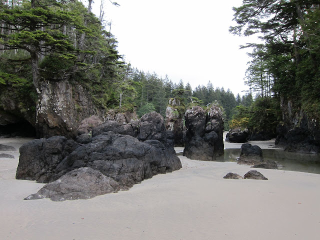
Anyways, I am glad that I also went to San Josef Bay. It is so beautiful and I didn't expect something like this in BC. It must look like some beaches in Asia, when it is sunny though.
Anyways, I am glad that I also went to San Josef Bay. It is so beautiful and I didn't expect something like this in BC. It must look like some beaches in Asia, when it is sunny though.
 |
| almost looks man made |
A part of the trail to the actual campsite is only passable on low tide, there is an overland track though.
 |
| campsite, sunset is approaching |
I was a bit cold, because of all the rain and it took me a while to pitch my tent in the loose sand. Next time I will bring better stakes. The plastic ones just don't do the job. I had a good last night sleep, though. There were some bear footprints on the sand 20 meters in front of my tent the next morning. Nobody heard or saw them though. Seems like that I wouldn't be able to see them at all in Canada.
I took my time that morning, broke up my camp and had to use the overgrown overland track to get back to the car park.
 | ||
| last glimpse of the rocks at St. Josef Bay |
The last few km to the car park were easy and I just had to wait for my shuttle bus back to Port Hardy.
 |
| the famous shoe tree on the gravel road back to Port Hardy |
I stayed another night at the Hostel in Port Hardy, had a huge dinner and took the bus back to Nainamo the next day.
Sitting in the bus I was quite surprised how much of Vancouver Island has been logged over the years. Over 80 % over the Island's forest is not pristine or lush rain forest anymore. It is mostly 2nd or 3rd generation trees now.
I ended my trip with a beautiful ferry ride back to Vancouver in perfect weather:
It was a great experience and I was pretty lucky with the weather. I saw some wildlife (wolf, many eagles, a whale in the distance, jumping salmons and a sea otter), I yet have to see a bear that is not behind an electric fence on Grouse Mountain. :)
I can highly recommend this hike, you just have to like sand, because it gets everywhere.


No comments:
Post a Comment